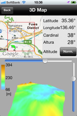

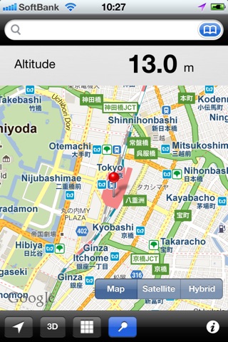

AltitudeMap is an application to show the elevation of various points around the world*. This app can display 2D and 3D topographical (terrain) map. You can calculate the altitude of any of the following areas (for example, somewhere areas less than 10m).
This app is using the SRTM-3 (3-arcsec, 90m) data.
Features
• Units of length. (m,ft,syaku)
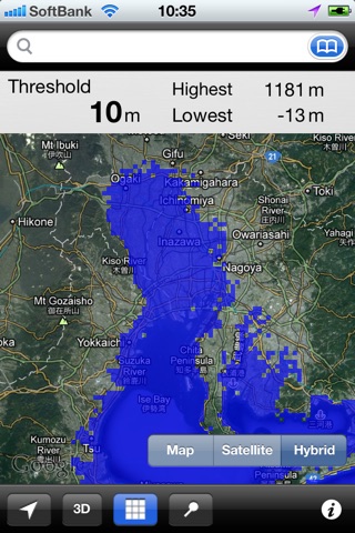
• Display area below the threshold values.
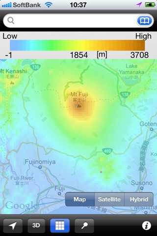
• Display a Heat Map.
• Bookmark.
• 3D Map.
• Stereopsis (Require VR Scope).
Cautions
• Supports importing data by iTunes.(SRTM-3,File format hgt)
• The elevation values are not exact.
• No elevation data points (such as islands and waters etc) are.
• The map display, you need a connection to the Internet.
*In the default state, only in Japan.You need to import the SRTM-3(File format hgt) data to display.
For example, Elevation data in Tokyo(Longitude/latitude N35.6/E139.7) are included in “N35E139.hgt” file.
You can be imported using the File Sharing feature of iTunes.